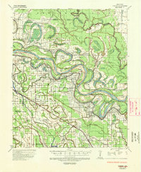
1935 Map of Varner
USGS Topo · Published 1947About this map
Arkansas River meanders define the social and agricultural landscape of this delta region, where large-scale operations like State Penal Farm No 5 and State Penal Farm No 1 occupy the fertile bends. The presence of the State Pen Cotton Gin near Cummins underscores the industrial-agricultural economy of the mid-1930s. This survey captures a dense network of spiritual and educational centers vital to rural genealogy, including the Antioch Ch & Sch and Pleasant Grove Ch & Cem. The influence of transportation is evident in the Memphis Vicksburg and Missouri Pacific railroad lines that connect settlements such as Grady and Reydel to larger markets. Complex waterways like Bayou Meto and Swan Lake crisscross the territory, illustrating the hydrological challenges of a region where flood control was a primary concern for the War Department and Corps of Engineers.
Find a feature on this map
107 named features on this map. Tap any name to fly to it.
Don’t see what you’re looking for? This feature index may not catch every label — zoom into the map to look around manually.
Map Details
Editions of this 1935 Varner Map
3 editions found
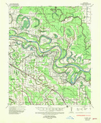
Other maps of this area

1935 · Feenyville
USGS Topo · 1:62,500

1935 · Altheimer
USGS Topo · 1:62,500

1935 · Varner
USGS Topo · 1:62,500

1935 · Noble Lake
USGS Topo · 1:62,500

1935 · Rotan
USGS Topo · 1:62,500

1935 · Red Fork
USGS Topo · 1:62,500

1935 · Gillett
USGS Topo · 1:62,500

1941 · De Witt
USGS Topo · 1:62,500

1941 · Goldman
USGS Topo · 1:62,500

1948 · Helena
USGS Topo · 1:250,000