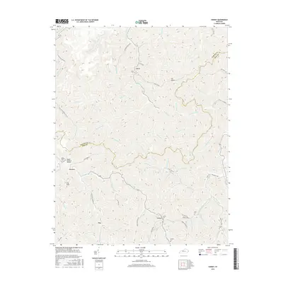
2016 Map of Varney
USGS Topo · Published 2016About this map
Varney and its surrounding hollows are meticulously documented in this topographic study of the central Appalachian landscape. The settlement pattern follows the intricate drainage network of the Pigeonroost Fork and Brushy Fork, where small communities like Laura, Piso, and Heenon developed along the narrow valley floors. For genealogists and local historians, the map preserves the locations of numerous family-named landmarks and burial sites, including Varney Cem, Smith Cem, and Francis Cem.
Find a feature on this map
72 named features on this map. Tap any name to fly to it.
Don’t see what you’re looking for? This feature index may not catch every label — zoom into the map to look around manually.
Map Details
Editions of this 2016 Varney Map
This is the sole edition of this map. No revisions or reprints were ever made.
Other maps of this area

1886 · Prestonsburg
USGS Topo · 1:125,000

1887 · Warfield
USGS Topo · 1:125,000

1891 · Warfield
USGS Topo · 1:125,000

1892 · Prestonsburg
USGS Topo · 1:125,000

1910 · Naugatuck
USGS Topo · 1:48,000

1912 · Naugatuck
USGS Topo · 1:62,500

1914 · Laynesville
USGS Topo · 1:48,000

1914 · Inez
USGS Topo · 1:48,000

1915 · Williamson
USGS Topo · 1:48,000

1915 · Naugatuck
USGS Topo · 1:48,000