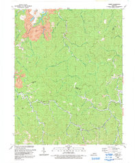
1992 Map of Varney
USGS Topo · Published 1992About this map
Deep hollows and narrow ridges along the Martin Co Pike Co line define this area of eastern Kentucky as it appeared in the early 1990s. The community of Varney sits along the southern edge, while other small settlements like Heenon and Piso are tucked into the valleys of Brushy Fork and Little Lick Fork. The landscape is heavily marked by the region's extraction history, featuring several Mines and a significant Strip Mine in the northwest corner near Petercave Fork.
Find a feature on this map
58 named features on this map. Tap any name to fly to it.
Don’t see what you’re looking for? This feature index may not catch every label — zoom into the map to look around manually.
Map Details
Editions of this 1992 Varney Map
This is the sole edition of this map. No revisions or reprints were ever made.
Other maps of this area

1886 · Prestonsburg
USGS Topo · 1:125,000

1887 · Warfield
USGS Topo · 1:125,000

1891 · Warfield
USGS Topo · 1:125,000

1892 · Prestonsburg
USGS Topo · 1:125,000

1910 · Naugatuck
USGS Topo · 1:48,000

1912 · Naugatuck
USGS Topo · 1:62,500

1914 · Laynesville
USGS Topo · 1:48,000

1914 · Inez
USGS Topo · 1:48,000

1915 · Williamson
USGS Topo · 1:48,000

1915 · Naugatuck
USGS Topo · 1:48,000