Loading...
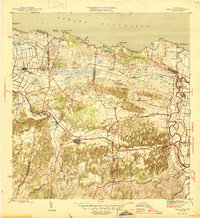
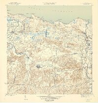
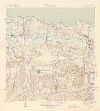
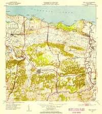
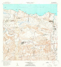
Loading map...1946 Map of Vega Alta
USGS Topo · Published 1946About this map
Sugar production and coastal rail transit dominate this mid-century landscape along the Océano Atlántico. The infrastructure of the sugar industry is prominent, with several large processing centers including Central San Vicente, Central Carmen, and Central Constancia serving as local hubs. These centers are linked by the American Railroad of Porto Rico, which features specialized stops and spurs like Estación Toa Baja and the Desvío Sardinera.
Find a feature on this map
54 named features on this map. Tap any name to fly to it.
Don’t see what you’re looking for? This feature index may not catch every label — zoom into the map to look around manually.
Map Details
Date Portrayed1946
Date Published1946
PublisherU.S. Geological Survey
Map TypeTopographic
Scale1:30,000
Physical Dimensions19.6 x 21.3 inches
Editions of this 1946 Vega Alta Map
4 editions found

Historical Maps of Dorado Through Time
8 maps found


Featured Locations
Source Details
SourceU.S. Geological Survey
CopyrightPublic Domain