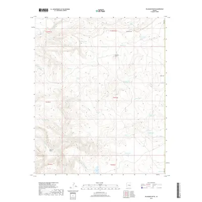
2018 Map of Velasquez Butte
USGS Topo · Published 2018About this map
Velasquez Butte rises as a prominent landmark in this high-elevation landscape within Navajo County, situated just north of the border with Gila County. The terrain is defined by a complex network of seasonal drainages and canyons, including the significant White Cow Canyon and the headwaters of Nash Cr. This 2018 survey reveals a landscape heavily managed for water, evidenced by the numerous named tanks and springs that support local ranching or wildlife needs. Strategic water sources like Navajo Bill Spring, L-Eleven Spring, and Benedict Spring are scattered across the higher elevations, while named features such as Tin Shack Tank Number One and Lower Camp Tank suggest a history of seasonal camps and cattle operations. The presence of Sevenmile Rim and Indian Flat further characterizes the varied topography of this remote Arizona territory.
Find a feature on this map
32 named features on this map. Tap any name to fly to it.
Don’t see what you’re looking for? This feature index may not catch every label — zoom into the map to look around manually.
Map Details
Editions of this 2018 Velasquez Butte Map
This is the sole edition of this map. No revisions or reprints were ever made.
Other maps of this area

1954 · Clifton
USGS Topo · 1:250,000

1954 · Mesa
USGS Topo · 1:250,000

1957 · Mesa
USGS Topo · 1:250,000

1957 · Clifton
USGS Topo · 1:250,000

1958 · Clifton
USGS Topo · 1:250,000

1958 · Mesa
USGS Topo · 1:250,000

1960 · Mesa
USGS Topo · 1:250,000

1962 · Clifton
USGS Topo · 1:250,000

1964 · Mesa
USGS Topo · 1:250,000

1966 · Georges Butte
USGS Topo · 1:24,000