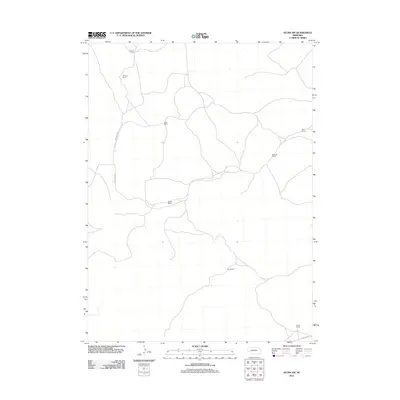
2011 Map of Velma SW
USGS Topo · Published 2011About this map
Arthur County ranching heritage is preserved in this 2011 survey, showing a landscape defined by expansive holdings and winding sandhills roads. Named homesteads like the Starkey Ranch and Hall Ranch serve as primary anchors in this sparsely populated territory, illustrating the continued importance of family-named landmarks in the Nebraska Panhandle. The network of roads, including Valentine Rd and Carlholm Dr, reflects the practical geography of a remote cattle-country economy. Tracing the placement of McCollin Ranch and Wymore Ranch, researchers can observe the spatial organization of these large agricultural tracts. The map provides a clear look at the infrastructure supporting this rural area, from the southern Lewellen Rd to northern outposts like O Lane Ranch, documenting the region's contemporary land use and connectivity.
Find a feature on this map
11 named features on this map. Tap any name to fly to it.
Don’t see what you’re looking for? This feature index may not catch every label — zoom into the map to look around manually.
Map Details
Editions of this 2011 Velma SW Map
This is the sole edition of this map. No revisions or reprints were ever made.
Other maps of this area

1897 · Ogallala
USGS Topo · 1:125,000

1900 · Chappell
USGS Topo · 1:125,000

1900 · Ogallala
USGS Topo · 1:125,000

1949 · Rackett
USGS Topo · 1:62,500

1950 · Velma
USGS Topo · 1:62,500

1951 · Rackett
USGS Topo · 1:62,500

1954 · Scottsbluff
USGS Topo · 1:250,000

1954 · North Platte
USGS Topo · 1:250,000

1956 · North Platte
USGS Topo · 1:250,000

1957 · North Platte
USGS Topo · 1:250,000