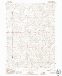
1986 Map of Velma SW
USGS Topo · Published 1986About this map
The rolling hills of the Nebraska Sandhills are the primary focus of this 1980s provisional study, showing a landscape defined by its depressions and peaks. The boundary between Garden Co and Arthur Co runs north-to-south through the western portion of the map, dividing these high-plains counties. Human presence is sparse in this environment, with the White Ranch in the southeast corner serving as a primary point of interest for local history researchers and genealogists tracking ranching operations in the region. The map primarily records the intricate topography of the dune formations and the unimproved trails that navigate between them, illustrating the remote character of the area prior to later developments.
Find a feature on this map
2 named features on this map. Tap any name to fly to it.
Don’t see what you’re looking for? This feature index may not catch every label — zoom into the map to look around manually.
Map Details
Editions of this 1986 Velma SW Map
This is the sole edition of this map. No revisions or reprints were ever made.
Other maps of this area

1897 · Ogallala
USGS Topo · 1:125,000

1900 · Chappell
USGS Topo · 1:125,000

1900 · Ogallala
USGS Topo · 1:125,000

1949 · Rackett
USGS Topo · 1:62,500

1950 · Velma
USGS Topo · 1:62,500

1951 · Rackett
USGS Topo · 1:62,500

1954 · Scottsbluff
USGS Topo · 1:250,000

1954 · North Platte
USGS Topo · 1:250,000

1956 · North Platte
USGS Topo · 1:250,000

1957 · North Platte
USGS Topo · 1:250,000