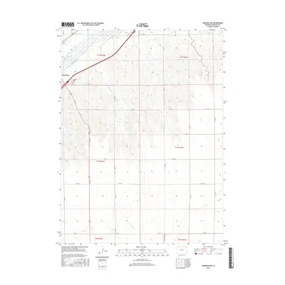
2016 Map of Venango NW
USGS Topo · Published 2016About this map
Julesburg sits at the edge of this northeastern Colorado landscape, where the valley of the South Platte River meets the expansive high plains of Sedgwick County. The map details a transition from the river's riparian corridor to a grid-defined agricultural interior. Significant for local family historians, the Julesburg Hillside Cem is situated on the rising ground overlooking the town. Water management is a primary theme of the terrain, visible in the course of the State Line Ditch and Spring Cr. The land is organized by a dense network of rural routes, including many county roads and sections of Trail Rd, reflecting the late-century reliance on precise section-line boundaries for property and transit in this corner of the state.
Find a feature on this map
29 named features on this map. Tap any name to fly to it.
Don’t see what you’re looking for? This feature index may not catch every label — zoom into the map to look around manually.
Map Details
Editions of this 2016 Venango NW Map
This is the sole edition of this map. No revisions or reprints were ever made.
Other maps of this area

1900 · Chappell
USGS Topo · 1:125,000

1952 · Julesburg SE
USGS Topo · 1:24,000

1953 · Julesburg
USGS Topo · 1:24,000

1954 · Sterling
USGS Topo · 1:250,000

1954 · Scottsbluff
USGS Topo · 1:250,000

1958 · Scottsbluff
USGS Topo · 1:250,000

1958 · Sterling
USGS Topo · 1:250,000

1961 · Barton
USGS Topo · 1:24,000

1961 · Big Springs
USGS Topo · 1:24,000

1961 · Chappell SE
USGS Topo · 1:24,000