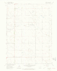
1962 Map of Venango SW
USGS Topo · Published 1963About this map
Rolling Prairie and the surrounding high plains of northeastern Colorado are defined by a network of intermittent watercourses and small rural schoolhouses in this early 1960s study. The landscape is characterized by the Sand Draw and Sand Creek drainages, which provide the primary topographic relief in an area otherwise dedicated to expansive agricultural sections. For local historians and genealogists, the identification of the Rolling Prairie Sch and South Plainview Sch reveals the locations of former community centers that served the surrounding farmsteads. Public land use is represented by the Sand Draw Management Area, while a grid of section lines and secondary roads connects the scattered improvements of this Sedgwick County landscape.
Find a feature on this map
5 named features on this map. Tap any name to fly to it.
Don’t see what you’re looking for? This feature index may not catch every label — zoom into the map to look around manually.
Map Details
Editions of this 1962 Venango SW Map
3 editions found
Other maps of this area

1952 · Julesburg SE
USGS Topo · 1:24,000

1953 · Julesburg
USGS Topo · 1:24,000

1954 · Sterling
USGS Topo · 1:250,000

1958 · Sterling
USGS Topo · 1:250,000

1962 · Venango SW
USGS Topo · 1:24,000
1962 · Venango NE
USGS Topo · 1:24,000

1962 · Holyoke NE
USGS Topo · 1:24,000

1962 · Amherst
USGS Topo · 1:24,000
1962 · Venango NW
USGS Topo · 1:24,000

1962 · Amherst NE
USGS Topo · 1:24,000