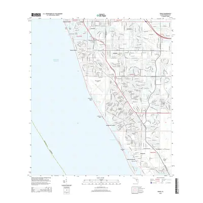
2015 Map of Venice
USGS Topo · Published 2015About this map
Venice and its surrounding coastal communities are defined by a complex network of residential developments and marine infrastructure along the Gulf of Mexico. The landscape is bisected by the Intracoastal Waterway, which separates the mainland from barrier features like Casey Key and Manasota Key. This 2015 survey illustrates the dense suburban expansion of South Venice and Venice East, organized around arterial routes like the Tamiami Trl S. Significant civil aviation and maritime transit infrastructure are prominent, including the Venice Municipal Airport and the Manasota Bridge crossing into Lemon Bay. Smaller historical settlement markers like Eagle Point and Nokomis persist amidst newer neighborhoods, while water bodies such as Alligator Creek and Hatchett Creek dictate the drainage and layout of the contemporary Gulf Coast environment.
Find a feature on this map
49 named features on this map. Tap any name to fly to it.
Don’t see what you’re looking for? This feature index may not catch every label — zoom into the map to look around manually.
Map Details
Editions of this 2015 Venice Map
This is the sole edition of this map. No revisions or reprints were ever made.
Other maps of this area

1943 · Laurel
USGS Topo · 1:24,000

1944 · Bird Keys
USGS Topo · 1:31,680

1944 · Lower Myakka Lake
USGS Topo · 1:31,680

1944 · Myakka River
USGS Topo · 1:31,680

1944 · Laurel
USGS Topo · 1:31,680

1944 · Venice
USGS Topo · 1:31,680

1956 · Englewood
USGS Topo · 1:24,000

1956 · Tampa
USGS Topo · 1:250,000

1956 · Charlotte Harbor
USGS Topo · 1:250,000

1957 · Englewood NW
USGS Topo · 1:24,000