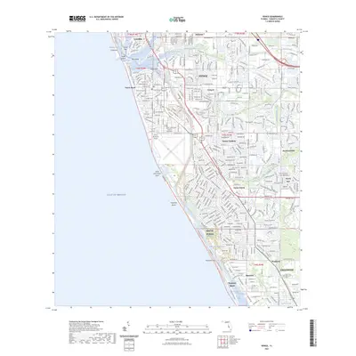
2023 Map of Venice
USGS Topo · Published 2023About this map
Venice and its surrounding coastal communities are defined by an intricate network of bays and man-made channels along the Gulf Coast. The Intracoastal Waterway serves as a primary transit artery, separating the mainland from barrier features like Casey Key and Manasota Key. This coastal geography is further shaped by Venice Inlet, which provides access between the Gulf of Mexico and the protected waters of Lyons Bay, Dona Bay, and Roberts Bay.
Find a feature on this map
43 named features on this map. Tap any name to fly to it.
Don’t see what you’re looking for? This feature index may not catch every label — zoom into the map to look around manually.
Map Details
Editions of this 2023 Venice Map
This is the sole edition of this map. No revisions or reprints were ever made.
Other maps of this area

1943 · Laurel
USGS Topo · 1:24,000

1944 · Bird Keys
USGS Topo · 1:31,680

1944 · Lower Myakka Lake
USGS Topo · 1:31,680

1944 · Myakka River
USGS Topo · 1:31,680

1944 · Laurel
USGS Topo · 1:31,680

1944 · Venice
USGS Topo · 1:31,680

1956 · Englewood
USGS Topo · 1:24,000

1956 · Tampa
USGS Topo · 1:250,000

1956 · Charlotte Harbor
USGS Topo · 1:250,000

1957 · Englewood NW
USGS Topo · 1:24,000