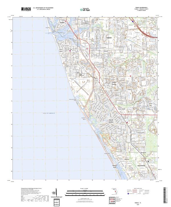
2025 Map of Venice
USGS Topo · Published 2025About this map
Venice and its surrounding coastal communities anchor this detailed coastal survey, showing a landscape defined by intricate waterways and modern residential expansion. The Intracoastal Waterway carves a path behind the barrier islands of Casey Key and Manasota Key, connecting Blackburn Bay, Dona Bay, and Roberts Bay with Lemon Bay to the south. This network of sounds and canals creates a distinctive geography where land and water are tightly integrated, supporting local landmarks like the Venice Municipal Airport and Venice High Sch.
Find a feature on this map
39 named features on this map. Tap any name to fly to it.
Don’t see what you’re looking for? This feature index may not catch every label — zoom into the map to look around manually.
Map Details
Editions of this 2025 Venice Map
This is the sole edition of this map. No revisions or reprints were ever made.
Other maps of this area

1943 · Laurel
USGS Topo · 1:24,000

1944 · Bird Keys
USGS Topo · 1:31,680

1944 · Lower Myakka Lake
USGS Topo · 1:31,680

1944 · Myakka River
USGS Topo · 1:31,680

1944 · Laurel
USGS Topo · 1:31,680

1944 · Venice
USGS Topo · 1:31,680

1956 · Englewood
USGS Topo · 1:24,000

1956 · Tampa
USGS Topo · 1:250,000

1956 · Charlotte Harbor
USGS Topo · 1:250,000

1957 · Englewood NW
USGS Topo · 1:24,000