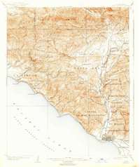
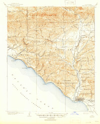
1904 Map of Ventura
USGS Topo · Published 1938About this map
The coastal shelf and inland valleys of Southern California are documented here just after the turn of the century, showing a landscape of sprawling ranchos and emerging citrus towns. The city of Ventura anchors the southern coastline, where the Southern Pacific railroad follows the curve of the Pacific Ocean toward Seacliff and Punta Gorda. Inland, the Ojai Valley is a distinct basin defined by the Sulphur Mountain range, featuring early settlements like Ojai and the resort-oriented Vickers Hot Springs.
Find a feature on this map
84 named features on this map. Tap any name to fly to it.
Don’t see what you’re looking for? This feature index may not catch every label — zoom into the map to look around manually.
Map Details
Editions of this 1904 Ventura Map
6 editions found
Other maps of this area

1902 · Santa Ynez
USGS Topo · 1:125,000

1903 · Santa Paula
USGS Topo · 1:62,500

1903 · Mt. Pinos
USGS Topo · 1:125,000

1904 · Ventura
USGS Topo · 1:62,500

1904 · Hueneme
USGS Topo · 1:62,500

1905 · Santa Ynez
USGS Topo · 1:125,000

1941 · Ventura
USGS Topo · 1:62,500

1942 · Santa Paula
USGS Topo · 1:62,500

1942 · Hueneme
USGS Topo · 1:62,500

1942 · Wheeler Springs
USGS Topo · 1:24,000