
1957 Map of Venus
USGS Topo · Published 1958About this map
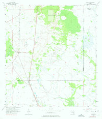
Venus serves as the central focal point of this 1950s survey, situated along the north-south corridor of the Atlantic Coast Line railroad. The landscape is defined by the transition between the sandy ridges of south-central Florida and the expansive marshlands that stretch toward the south. The drainage patterns are dominated by Rattlesnake Branch, which winds through the western portion of the quadrangle. A significant geographic division is marked by the Highlands Co Glades Co boundary line, which cuts across the lower third of the map. This era of mapping shows the region's sparse settlement and heavy reliance on the rail line for connectivity, with much of the interior remaining as open wetland and undeveloped scrub typical of the interior citrus and ranching country.
Find a feature on this map
4 named features on this map. Tap any name to fly to it.
Don’t see what you’re looking for? This feature index may not catch every label — zoom into the map to look around manually.
Map Details
Editions of this 1957 Venus Map
3 editions found
Other maps of this area

1953 · Brighton NW
USGS Topo · 1:24,000

1953 · Brighton SW
USGS Topo · 1:24,000

1953 · Venus NW
USGS Topo · 1:24,000

1953 · Childs
USGS Topo · 1:24,000

1956 · West Palm Beach
USGS Topo · 1:250,000

1956 · Fort Pierce
USGS Topo · 1:250,000

1957 · West Palm Beach
USGS Topo · 1:250,000

1957 · Venus SW
USGS Topo · 1:24,000

1958 · Fort Pierce
USGS Topo · 1:250,000

1958 · West Palm Beach
USGS Topo · 1:250,000