
1969 Map of Verbena
USGS Topo · Published 1971About this map
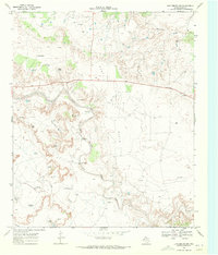
The community of Verbena sits on the high plains of Garza County, overlooking the deeply incised canyon system formed by the Salt Fork Brazos River. This 1960s landscape is defined by the transition from flat cotton-growing tablelands to the broken, erosive drainage networks of McDonald Creek and Slicknasty Creek. The topographic detail reveals a region balancing agricultural land use with emerging energy extraction, as evidenced by the numerous drill holes and the Post Oil Field occupying the southern reaches.
Find a feature on this map
14 named features on this map. Tap any name to fly to it.
Don’t see what you’re looking for? This feature index may not catch every label — zoom into the map to look around manually.
Map Details
Editions of this 1969 Verbena Map
This is the sole edition of this map. No revisions or reprints were ever made.
Other maps of this area

1954 · Lubbock
USGS Topo · 1:250,000

1962 · Twomile Creek
USGS Topo · 1:24,000

1962 · Smith Tank
USGS Topo · 1:24,000

1966 · Kalgary
USGS Topo · 1:24,000

1966 · Canyon Valley
USGS Topo · 1:24,000

1969 · Cap Rock SE
USGS Topo · 1:24,000

1969 · Cottonwood Creek
USGS Topo · 1:24,000
1969 · Justiceburg NW
USGS Topo · 1:24,000

1969 · Post East
USGS Topo · 1:24,000
1986 · Slaton
USGS Topo · 1:100,000