1892 Map of Verde
USGS Topo · Published 1902About this map
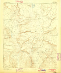
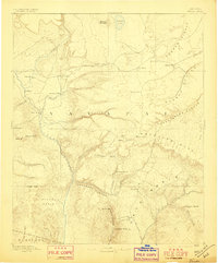
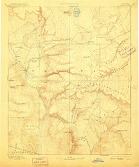
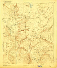
The Verde River drainage and the towering escarpment of the Mogollon Mesa dominate this late 19th-century reconnaissance. The mapping captures the frontier character of central Arizona during a period when Fort Verde served as a primary anchor for regional settlement. Scattered pioneer outposts like Strawberry, Pine, and Payson are clustered in the foothills, while the landscape transition from the high Mormon Mountain to the depths of Bloody Basin is clearly defined. Notable landmarks such as Natural Bridge and the geological curiosity of Montezuma Well appear alongside infrastructure projects like The Tunnel. The map also traces a network of water sources essential to the era's survival, including Pine Spring and Stoneman Lake, marking the locations of early tanks and ranches like Potato Ranch that supported the cattle and ranching expansion into Yavapai and Maricopa counties.
Find a feature on this map
55 named features on this map. Tap any name to fly to it.
Don’t see what you’re looking for? This feature index may not catch every label — zoom into the map to look around manually.
Map Details
Editions of this 1892 Verde Map
5 editions found
Other maps of this area

1883 · Tusayan
USGS Topo · 1:250,000

1886 · Tusayan
USGS Topo · 1:250,000

1886 · San Francisco Mtns
USGS Topo · 1:250,000

1886 · Chino
USGS Topo · 1:250,000

1886 · Holbrook
USGS Topo · 1:250,000

1887 · Verde
USGS Topo · 1:250,000

1887 · Prescott
USGS Topo · 1:250,000

1891 · San Francisco Mtns
USGS Topo · 1:250,000

1891 · Chino
USGS Topo · 1:250,000

1892 · Verde
USGS Topo · 1:250,000