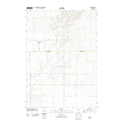
2013 Map of Verdi
USGS Topo · Published 2013About this map
Verdi anchors this agricultural corner of Southwestern Minnesota, situated right on the boundary line between Lincoln and Pipestone Counties. The landscape here is defined by the gradual drainage patterns of the prairie, with Spring Cr and Willow Cr cutting through the open country. The town itself is compactly mapped around a grid of streets including Front Street and Center Street, with the local post office serving as a central point for the surrounding farmsteads. This 2013 survey illustrates the modern road network, dominated by U.S. Highway 75 and several county highways that connect this rural community to the larger trade centers of the region.
Find a feature on this map
3 named features on this map. Tap any name to fly to it.
Don’t see what you’re looking for? This feature index may not catch every label — zoom into the map to look around manually.
Map Details
Editions of this 2013 Verdi Map
This is the sole edition of this map. No revisions or reprints were ever made.
Other maps of this area

1953 · Watertown
USGS Topo · 1:250,000

1958 · Watertown
USGS Topo · 1:250,000

1963 · Tyler
USGS Topo · 1:24,000

1967 · Pipestone North
USGS Topo · 1:24,000

1967 · Ruthton NW
USGS Topo · 1:24,000

1967 · Elkton SW
USGS Topo · 1:24,000

1967 · Verdi
USGS Topo · 1:24,000

1967 · Lake Benton
USGS Topo · 1:24,000

1967 · Lake Benton SW
USGS Topo · 1:24,000
1967 · Holland
USGS Topo · 1:24,000