
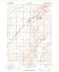
1967 Map of Verdi
USGS Topo · Published 1968About this map
Verdi anchors the upper-left of this mid-century survey, situated at the crossing of the Chicago and North Western railroad and local county lines. The landscape is defined by the drainage systems of Flandreau Creek and its East Branch, which carve through the prairie terrain of Altona and Fountain Prairie townships. Evidence of local industry is scattered throughout the region in the form of numerous Gravel Pits, indicating the geological utility of the area's glacial deposits.
Find a feature on this map
15 named features on this map. Tap any name to fly to it.
Don’t see what you’re looking for? This feature index may not catch every label — zoom into the map to look around manually.
Map Details
Editions of this 1967 Verdi Map
This is the sole edition of this map. No revisions or reprints were ever made.
Other maps of this area

1953 · Watertown
USGS Topo · 1:250,000

1958 · Watertown
USGS Topo · 1:250,000

1963 · Tyler
USGS Topo · 1:24,000

1967 · Pipestone North
USGS Topo · 1:24,000

1967 · Ruthton NW
USGS Topo · 1:24,000

1967 · Elkton SW
USGS Topo · 1:24,000

1967 · Lake Benton
USGS Topo · 1:24,000

1967 · Lake Benton SW
USGS Topo · 1:24,000
1967 · Holland
USGS Topo · 1:24,000

1967 · Elkton
USGS Topo · 1:24,000