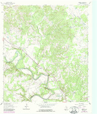
1962 Map of Verhelle
USGS Topo · Published 1987About this map
The Guadalupe River carves a winding path through this corner of DeWitt County, shaping a landscape defined by its riparian bends and the industrial footprint of the Thomaston Oil Field. The small settlement of Verhelle and the nearby Burns Station Cem sit adjacent to the Southern Pacific tracks, which cut a sharp diagonal line across the terrain. This 1962 survey, with revisions noted through the 1980s, reveals a rural economy balancing traditional land use with infrastructure, evidenced by the Thomaston Compressor Sta and scattered gravel pits. For family historians, the map preserves the locations of several burial grounds, including the Ponteon San Isidro Labrador Cem and Thomaston Community Cem, alongside spiritual landmarks like Mt Bethany Ch. Numerous small waterways such as Irish Creek, Jennie Bell Creek, and Sandy Fork drain the wooded hollows toward the main river valley.
Find a feature on this map
27 named features on this map. Tap any name to fly to it.
Don’t see what you’re looking for? This feature index may not catch every label — zoom into the map to look around manually.
Map Details
Editions of this 1962 Verhelle Map
2 editions found
Other maps of this area

1953 · Beeville
USGS Topo · 1:250,000

1953 · Seguin
USGS Topo · 1:250,000

1956 · Beeville
USGS Topo · 1:250,000

1958 · Seguin
USGS Topo · 1:250,000

1960 · Beeville
USGS Topo · 1:250,000

1960 · Cuero
USGS Topo · 1:24,000

1960 · Concrete
USGS Topo · 1:24,000

1962 · Verhelle
USGS Topo · 1:24,000

1962 · Edgar
USGS Topo · 1:24,000

1962 · Terryville
USGS Topo · 1:24,000