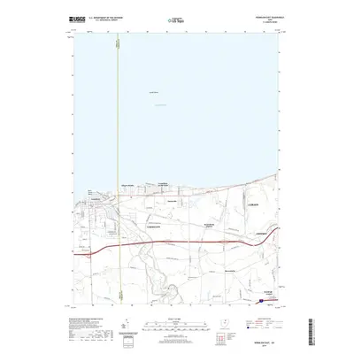
2019 Map of Vermilion East
USGS Topo · Published 2019About this map
The southern shoreline of Lake Erie defines the character of this 2019 survey, where the Vermilion River meets the lake at the port of Vermilion. The landscape transitions from the developed beach communities of Elberta Beach and Vermilion-on-the-Lake into the interior farmlands of Lorain County. Inland, the map reveals a history of rural settlement tied to the land and smaller waterways like Edson Cr and Brownhelm Cr. Numerous family and local burial sites, including Rugby Cem and Brownhelm Cem, are preserved among the modern road networks.
Find a feature on this map
82 named features on this map. Tap any name to fly to it.
Don’t see what you’re looking for? This feature index may not catch every label — zoom into the map to look around manually.
Map Details
Editions of this 2019 Vermilion East Map
This is the sole edition of this map. No revisions or reprints were ever made.
Other maps of this area

1901 · Oberlin
USGS Topo · 1:62,500

1903 · Vermilion
USGS Topo · 1:62,500

1903 · Oberlin
USGS Topo · 1:62,500

1956 · Toledo
USGS Topo · 1:250,000

1959 · Berlin Heights
USGS Topo · 1:24,000

1959 · Vermilion East
USGS Topo · 1:24,000

1959 · Vermilion West
USGS Topo · 1:24,000

1959 · Kipton
USGS Topo · 1:24,000

1960 · Oberlin
USGS Topo · 1:24,000
1960 · Lorain
USGS Topo · 1:24,000