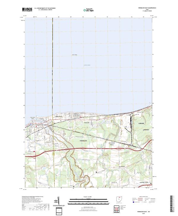
2023 Map of Vermilion East
USGS Topo · Published 2023About this map
The Vermilion River carves a deep, winding path through the landscape of Lorain and Erie counties as it approaches its mouth at Lake Erie. This modern topographical survey reveals a coastal corridor defined by established residential communities and recreational waterfronts, including the historic lakefront developments of Elberta Beach and Vermilion-on-the-Lake. Inland, the terrain transitions to the agricultural and suburban patchwork of Sunnyside and Brownhelm Station. Local history is preserved in small geographic markers like Rugby Cem and Brownhelm Cem, while the modern transportation infrastructure is dominated by the Norfolk Southern rail line and major thoroughfares such as Liberty Ave. Hydrological features like the Lake Haven Estates Reservoir and Deer Creek Run illustrate the drainage patterns of the Lorain Valley toward the Great Lakes shore.
Find a feature on this map
88 named features on this map. Tap any name to fly to it.
Don’t see what you’re looking for? This feature index may not catch every label — zoom into the map to look around manually.
Map Details
Editions of this 2023 Vermilion East Map
This is the sole edition of this map. No revisions or reprints were ever made.
Other maps of this area

1901 · Oberlin
USGS Topo · 1:62,500

1903 · Vermilion
USGS Topo · 1:62,500

1903 · Oberlin
USGS Topo · 1:62,500

1956 · Toledo
USGS Topo · 1:250,000

1959 · Berlin Heights
USGS Topo · 1:24,000

1959 · Vermilion East
USGS Topo · 1:24,000

1959 · Vermilion West
USGS Topo · 1:24,000

1959 · Kipton
USGS Topo · 1:24,000

1960 · Oberlin
USGS Topo · 1:24,000
1960 · Lorain
USGS Topo · 1:24,000