
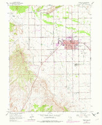
1964 Map of Vernal NE
USGS Topo · Published 1965About this map
Asphalt Ridge dominates the western landscape of this mid-1960s survey, illustrating the geologic foundation of the local extraction economy. The map documents the sprawling agricultural and civil infrastructure of Vernal, where the Central Canal, Steinaker Canal, and Service Canal weave through the Ashley Valley to support a network of farms and orchards. This irrigation system, managed in part through the Steinaker Feeder Canal and its associated dam, defines the boundary between the green valley floor and the arid high ground of Rock Point.
Find a feature on this map
46 named features on this map. Tap any name to fly to it.
Don’t see what you’re looking for? This feature index may not catch every label — zoom into the map to look around manually.
Map Details
Editions of this 1964 Vernal NE Map
2 editions found
Other maps of this area

1885 · Ashley
USGS Topo · 1:250,000

1906 · Marsh Peak
USGS Topo · 1:125,000

1907 · Jensen
USGS Topo · 1:125,000

1908 · Marsh Peak
USGS Topo · 1:125,000

1910 · Jensen
USGS Topo · 1:125,000

1917 · Vernal
USGS Topo · 1:125,000

1954 · Vernal
USGS Topo · 1:250,000

1958 · Vernal
USGS Topo · 1:250,000

1960 · Vernal
USGS Topo · 1:250,000
1964 · Vernal SW
USGS Topo · 1:24,000