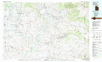
1980 Map of Vernal
USGS Topo · Published 1982About this map
Fort Duchesne serves as a central landmark in this 1980 survey, illustrating the intersection of historic settlement and the sprawling energy infrastructure of the Uintah Basin. The landscape is defined by the convergence of the Green River and White River, creating a complex network of waterways that supports the Ouray National Wildlife Refuge. To the north, the terrain transitions into the high-relief areas of Dinosaur National Monument and the Yampa Plateau, while the valley floors are marked by the extensive Walker Hollow Oil and Gas Field and Red Wash Oil and Gas Field.
Find a feature on this map
71 named features on this map. Tap any name to fly to it.
Don’t see what you’re looking for? This feature index may not catch every label — zoom into the map to look around manually.
Map Details
Editions of this 1980 Vernal Map
2 editions found
Other maps of this area

1885 · East Tavaputs
USGS Topo · 1:250,000

1885 · Ashley
USGS Topo · 1:250,000

1885 · Uinta
USGS Topo · 1:250,000

1886 · Price River
USGS Topo · 1:250,000

1896 · Price River
USGS Topo · 1:250,000

1905 · Gilbert Peak
USGS Topo · 1:125,000

1906 · Gilbert Peak
USGS Topo · 1:125,000

1906 · Marsh Peak
USGS Topo · 1:125,000

1907 · Rangely
USGS Topo · 1:125,000

1907 · Jensen
USGS Topo · 1:125,000