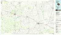
1986 Map of Vernon
USGS Topo · Published 1986About this map
The Red River carves a winding path across this mid-1980s landscape, serving as a natural boundary between Texas and Oklahoma. This survey highlights the agricultural and energy-driven economy of the region, featuring substantial infrastructure such as the Conley Oil Field and Fargo Oil Field. Transport routes are dominated by the Burlington Northern and Atchison Topeka and Santa Fe railroads, which connect established centers like Quanah and Vernon with smaller agricultural communities including Chillicothe and Oklaunion.
Find a feature on this map
88 named features on this map. Tap any name to fly to it.
Don’t see what you’re looking for? This feature index may not catch every label — zoom into the map to look around manually.
Map Details
Editions of this 1986 Vernon Map
This is the sole edition of this map. No revisions or reprints were ever made.
Other maps of this area

1916 · Electra
USGS Topo · 1:24,000

1917 · Beaver Creek
USGS Topo · 1:24,000

1918 · Electra
USGS Topo · 1:31,680

1920 · Beaver Creek
USGS Topo · 1:31,680

1927 · Quanah 3-a
USGS Topo · 1:48,000

1927 · Quanah 3-b
USGS Topo · 1:48,000

1932 · Vivian
USGS Topo · 1:62,500

1950 · Snyder
USGS Topo · 1:62,500

1954 · Lubbock
USGS Topo · 1:250,000

1954 · Plainview
USGS Topo · 1:250,000