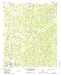
1967 Map of Vernon
USGS Topo · Published 1986About this map
Vernon serves as the focal point of this west Alabama landscape, situated where Yellow Creek and Buck Creek converge. The 1967 topography illustrates a well-connected rural community defined by its network of country roads, cemeteries, and houses of worship. Small drainages like Bogue Creek, Mill Creek, and Slickum Branch carve through the terrain, while the presence of the Lamar County Airport and a Drive-in Theater west of town indicates mid-century development. Genealogical interests are well-served by the numerous family and community sites, including Pearson Cem, Sanders Cem, and Moscow Ch. Farther north, the landscape remains largely wooded and dissected by several branches of Brush Creek, with scattered Gravel Pit operations marking the local industry. This survey provides a clear view of the area's transition into the late 20th century while retaining its traditional settlement patterns and ecclesiastical centers like Taylor Springs Ch and Fellowship Ch.
Find a feature on this map
52 named features on this map. Tap any name to fly to it.
Don’t see what you’re looking for? This feature index may not catch every label — zoom into the map to look around manually.
Map Details
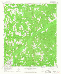
Editions of this 1967 Vernon Map
2 editions found
Other maps of this area

1953 · Birmingham
USGS Topo · 1:250,000

1953 · West Point
USGS Topo · 1:250,000

1956 · Birmingham
USGS Topo · 1:250,000

1957 · Birmingham
USGS Topo · 1:250,000

1958 · West Point
USGS Topo · 1:250,000

1963 · West Point
USGS Topo · 1:250,000

1967 · Sulligent
USGS Topo · 1:24,000

1967 · Beaverton
USGS Topo · 1:24,000

1967 · Hightogy
USGS Topo · 1:24,000

1967 · Bluff
USGS Topo · 1:24,000