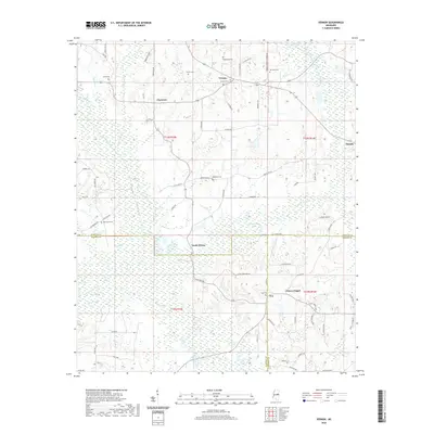
2020 Map of Vernon
USGS Topo · Published 2020About this map
Nanih Waiya serves as a focal point of this Mississippi landscape, situated at the intersection of Winston, Neshoba, and Kemper counties. The area is defined by its extensive water network, including the headwaters of the Bogue Chitto and the winding course of Nanih Waiya Creek. The map documents a predominantly rural region characterized by small settlements like Vernon, Claytown, and Coy, where community life historically centered around local landmarks such as Prince Chapel and Harmony Baptist Church. For genealogists and local historians, the numerous family-named cemeteries, including Fulton Cem, Whitehead Cem, and Oak Grove Cem, provide a direct connection to the early residents of these crossroads. The distribution of these burial sites and old road names like Asa Thomas Rd and J P Fulton Rd reflects the settlement patterns of East Central Mississippi.
Find a feature on this map
77 named features on this map. Tap any name to fly to it.
Don’t see what you’re looking for? This feature index may not catch every label — zoom into the map to look around manually.
Map Details
Editions of this 2020 Vernon Map
This is the sole edition of this map. No revisions or reprints were ever made.
Other maps of this area

1953 · Meridian
USGS Topo · 1:250,000

1953 · West Point
USGS Topo · 1:250,000

1957 · Meridian
USGS Topo · 1:250,000

1958 · West Point
USGS Topo · 1:250,000

1962 · Lynville
USGS Topo · 1:24,000

1962 · Vernon
USGS Topo · 1:24,000

1962 · Owl Creek
USGS Topo · 1:24,000

1962 · Preston
USGS Topo · 1:24,000

1963 · West Point
USGS Topo · 1:250,000

1965 · Meridian
USGS Topo · 1:250,000