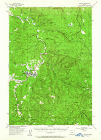
1955 Map of Vernonia
USGS Topo · Published 1973About this map
The Nehalem River defines the landscape of this mid-century Columbia County survey, winding past the hub of Vernonia, where the Mill Pond and Lincoln Sch anchor the community. The area is a complex network of resource extraction and early transport, evidenced by several quarries and a Coal deposit with an adjacent Tunnel. Local history and genealogy interests are well-represented by rural landmarks such as the Pioneer Cem and former educational sites like the Natal School (Aban'd) and Beaver Cr School (Aban'd). The industrial character of the era is further emphasized by the presence of the S P & S River Valley Line and the Portland Astoria and Pacific RR, which facilitated movement through the valley connecting smaller settlements like Pittsburg and Treharne.
Find a feature on this map
68 named features on this map. Tap any name to fly to it.
Don’t see what you’re looking for? This feature index may not catch every label — zoom into the map to look around manually.
Map Details
Editions of this 1955 Vernonia Map
3 editions found
Other maps of this area

1915 · Hillsboro
USGS Topo · 1:62,500

1918 · Hillsboro
USGS Topo · 1:62,500

1919 · Mayger
USGS Topo · 1:62,500

1921 · Kalama
USGS Topo · 1:62,500

1922 · St. Helens
USGS Topo · 1:62,500

1940 · Hillsboro
USGS Topo · 1:62,500

1940 · Vernonia
USGS Topo · 1:62,500

1941 · Keasey
USGS Topo · 1:62,500

1941 · St Helens
USGS Topo · 1:62,500

1941 · Timber
USGS Topo · 1:62,500