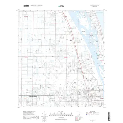
2018 Map of Vero Beach
USGS Topo · Published 2018About this map
The Indian River Lagoon and Intracoastal Waterway dominate this coastal landscape, separating the mainland settlements from the barrier island communities. Significant municipal development is centered around Vero Beach and Gifford, with the Vero Beach Regional Airport serving as a major landmark just north of the Main Canal. The map reveals the intricate network of finger islands and cuts that define the local hydrology, including Hole in the Wall Island and Oyster Cut. To the north, the smaller unincorporated communities of Wabasso and Winter Beach maintain a distinct footprint along the rail line and riverfront. This survey captures the intensive drainage efforts through features like the Main Canal, which manages water flow from the West Vero Corridor toward the Atlantic Ocean. Local history and genealogy interest is anchored by Hillcrest Memorial Gardens near the southern boundary.
Find a feature on this map
78 named features on this map. Tap any name to fly to it.
Don’t see what you’re looking for? This feature index may not catch every label — zoom into the map to look around manually.
Map Details
Editions of this 2018 Vero Beach Map
This is the sole edition of this map. No revisions or reprints were ever made.
Other maps of this area

1948 · Riomar
USGS Topo · 1:24,000

1948 · Indrio
USGS Topo · 1:24,000

1949 · Fellsmere
USGS Topo · 1:24,000

1949 · Vero Beach
USGS Topo · 1:24,000

1949 · Sebastian
USGS Topo · 1:24,000

1949 · Oslo
USGS Topo · 1:24,000

1950 · Riomar
USGS Topo · 1:24,000

1950 · Oslo
USGS Topo · 1:24,000

1950 · Indrio
USGS Topo · 1:24,000

1950 · Vero Beach
USGS Topo · 1:24,000