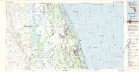
1981 Map of Vero Beach
USGS Topo · Published 1982About this map
Blue Cypress Lake and the expansive St Johns Marsh dominate the interior landscape of this 1980s Florida coastal survey, revealing a region defined by its complex hydrology and early modern development. Along the Atlantic shore, the Indian River Aquatic Reserve protects a string of barrier islands and lagoons, including the Pelican Island National Wildlife Refuge. The settlement pattern follows the established corridor of the Florida East Coast Railway and Florida's Turnpike, linking coastal communities like Sebastian and Vero Beach to the interior cattle and citrus lands near Kenansville. This map captures the area as coastal expansion began to push westward from the historical centers of Wabasso and Gifford, while specialized sites like the Valkaria Missile Tracking Station and the Fleming Grant land tract provide glimpses into the region's diverse military and colonial land-tenure history.
Find a feature on this map
53 named features on this map. Tap any name to fly to it.
Don’t see what you’re looking for? This feature index may not catch every label — zoom into the map to look around manually.
Map Details
Editions of this 1981 Vero Beach Map
This is the sole edition of this map. No revisions or reprints were ever made.
Other maps of this area

1948 · Riomar
USGS Topo · 1:24,000

1948 · Indrio
USGS Topo · 1:24,000

1949 · Melbourne West
USGS Topo · 1:24,000

1949 · Fellsmere
USGS Topo · 1:24,000

1949 · Fort Pierce
USGS Topo · 1:24,000

1949 · Melbourne East
USGS Topo · 1:24,000

1949 · Sebastian NW
USGS Topo · 1:24,000

1949 · Vero Beach
USGS Topo · 1:24,000

1949 · Sebastian
USGS Topo · 1:24,000

1949 · Oslo
USGS Topo · 1:24,000