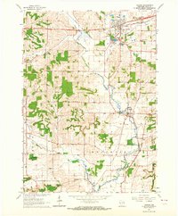
1962 Map of Verona
USGS Topo · Published 1964About this map
The Chicago and North Western corridor defines the northern landscape of this region, where the burgeoning village of Verona serves as a local hub near the County Hospital. Further south, the terrain becomes more intricately carved by the winding Sugar River and its tributaries, including Badger Mill Creek and Flynn Creek. Small rural communities like Paoli and Basco are situated along the riverbanks, anchored by local landmarks such as St Williams Cem and Paoli Cem. The map captures a transition in local infrastructure, showing the Illinois Central tracks passing through the southern settlements of Montrose and Basco. Educational history is well-represented by a network of one-room schoolhouses, including the McPherson Sch, Schaller Sch, and Andrew Henry Sch, reflecting the agricultural community's distributed nature during the early 1960s. This survey details a landscape where industry is limited to a few Gravel Pits and a Quarry, leaving the primary character one of valley-bottom farming and small-town commerce.
Find a feature on this map
31 named features on this map. Tap any name to fly to it.
Don’t see what you’re looking for? This feature index may not catch every label — zoom into the map to look around manually.
Map Details
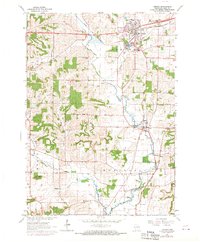
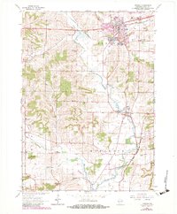
Editions of this 1962 Verona Map
3 editions found
Other maps of this area

1889 · Evansville
USGS Topo · 1:62,500

1890 · Madison
USGS Topo · 1:62,500

1892 · Madison
USGS Topo · 1:62,500

1894 · Evansville
USGS Topo · 1:62,500

1904 · Madison
USGS Topo · 1:62,500

1906 · Evansville
USGS Topo · 1:62,500
1906 · Madison
USGS Topo · 1:62,500

1907 · Cross Plains
USGS Topo · 1:62,500

1909 · Cross Plains
USGS Topo · 1:62,500

1923 · New Glarus
USGS Topo · 1:62,500