1962 Map of Verona
USGS Topo · Published 1970About this map
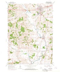
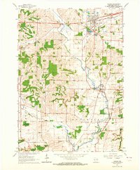
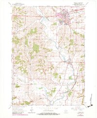
Verona serves as the primary hub in this 1960s study of southern Dane County, where the Sugar River and its various branches create a complex drainage pattern across Verona, Springdale, and Montrose townships. The landscape is defined by its rural infrastructure, featuring a notable density of country schoolhouses such as Andrew Henry Sch, McPherson Sch, and Harker Sch that serviced the surrounding farmsteads.
Find a feature on this map
33 named features on this map. Tap any name to fly to it.
Don’t see what you’re looking for? This feature index may not catch every label — zoom into the map to look around manually.
Map Details
Editions of this 1962 Verona Map
3 editions found
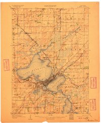
Other maps of this area

1889 · Evansville
USGS Topo · 1:62,500

1890 · Madison
USGS Topo · 1:62,500

1892 · Madison
USGS Topo · 1:62,500

1894 · Evansville
USGS Topo · 1:62,500

1904 · Madison
USGS Topo · 1:62,500

1906 · Evansville
USGS Topo · 1:62,500
1906 · Madison
USGS Topo · 1:62,500

1907 · Cross Plains
USGS Topo · 1:62,500

1909 · Cross Plains
USGS Topo · 1:62,500

1923 · New Glarus
USGS Topo · 1:62,500