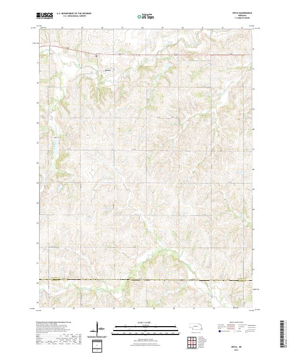
2021 Map of Vesta
USGS Topo · Published 2021About this map
Vesta serves as the central hub of this agricultural landscape in Johnson County, sitting near the northern reaches of the quadrangle. The terrain is defined by a dense network of drainage branches that feed into Yankee Creek and Turkey Cr, creating a rolling topography that dictates the section-line road grid. Local history is anchored at the Vesta Cem just north of the settlement, while the surrounding countryside is partitioned by numerous small waterways including Brewers Br, Lost Branch, and Sampson Br. The southern border of the map marks the significant transition from Johnson Co to Pawnee Co, a boundary that aligns with the established township and range system. This modern survey reflects the enduring rural character of the region, where named branches like Badger Br and Todd Br remain primary landmarks for property and land use.
Find a feature on this map
26 named features on this map. Tap any name to fly to it.
Don’t see what you’re looking for? This feature index may not catch every label — zoom into the map to look around manually.
Map Details
Editions of this 2021 Vesta Map
This is the sole edition of this map. No revisions or reprints were ever made.
Other maps of this area

1955 · Lincoln
USGS Topo · 1:250,000

1957 · Lincoln
USGS Topo · 1:250,000

1958 · Lincoln
USGS Topo · 1:250,000

1965 · Crab Orchard
USGS Topo · 1:24,000

1965 · Burchard
USGS Topo · 1:24,000

1965 · Sterling
USGS Topo · 1:24,000

1965 · Tecumseh
USGS Topo · 1:24,000
1965 · Steinauer
USGS Topo · 1:24,000

1965 · Lewiston
USGS Topo · 1:24,000
1965 · Tecumseh NW
USGS Topo · 1:24,000