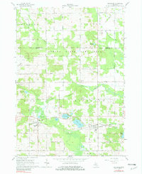
1965 Map of Vestaburg
USGS Topo · Published 1982About this map
Vestaburg stands as the primary settlement in this mid-1960s landscape, positioned along the Chesapeake and Ohio railroad corridor. The area is characterized by a high concentration of small kettle lakes and wetlands, including Rock Lake, Bass Lake, and Marl Lake, which shape the local geography and transportation routes. To the north, the Edmore State Game Area preserves a significant portion of the natural terrain, while the Pine River and its various branches, such as North Branch Pine River, drain the agricultural plains.
Find a feature on this map
59 named features on this map. Tap any name to fly to it.
Don’t see what you’re looking for? This feature index may not catch every label — zoom into the map to look around manually.
Map Details
Editions of this 1965 Vestaburg Map
2 editions found
Other maps of this area

1916 · Mount Pleasant
USGS Topo · 1:62,500

1919 · Mount Pleasant
USGS Topo · 1:62,500

1943 · Mount Pleasant
USGS Topo · 1:62,500

1954 · Midland
USGS Topo · 1:250,000

1958 · Midland
USGS Topo · 1:250,000

1959 · Midland
USGS Topo · 1:250,000

1964 · Edmore
USGS Topo · 1:24,000

1964 · Blanchard
USGS Topo · 1:24,000

1964 · Stanton
USGS Topo · 1:24,000

1965 · Vestaburg
USGS Topo · 1:24,000