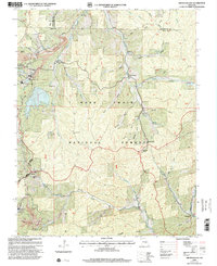
1999 Map of Viburnum East
USGS Topo · Published 2002About this map
Mark Twain National Forest dominates this Missouri landscape, where the heavy extraction of the Lead Belt is evident through extensive industrial features. Large-scale mining operations define the southwestern corner of the quadrangle, notably at the Magmont Mine and the St Joe Shaft 38. These industrial sites are accompanied by a network of tailings ponds, sewage disposal facilities, and an Air Shaft, illustrating the intensive mineral production in the Ozark region during the late 20th century.
Find a feature on this map
58 named features on this map. Tap any name to fly to it.
Don’t see what you’re looking for? This feature index may not catch every label — zoom into the map to look around manually.
Map Details
Editions of this 1999 Viburnum East Map
This is the sole edition of this map. No revisions or reprints were ever made.
Other maps of this area

1906 · Potosi
USGS Topo · 1:62,500

1924 · Edgehill
USGS Topo · 1:62,500

1926 · Edgehill
USGS Topo · 1:62,500

1943 · Berryman
USGS Topo · 1:62,500

1943 · Boss
USGS Topo · 1:62,500

1945 · Berryman
USGS Topo · 1:62,500

1946 · Boss
USGS Topo · 1:62,500

1949 · Rolla
USGS Topo · 1:250,000

1953 · Rolla
USGS Topo · 1:250,000

1954 · Rolla
USGS Topo · 1:250,000