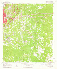
1962 Map of Vicksburg East
USGS Topo · Published 1963About this map
The Vicksburg National Military Park dominates the northwest corner of this 1960s landscape, tracing the complex Siege of Vicksburg defensive lines across the rugged loess bluffs. This survey documents the city of Vicksburg as it expanded eastward along the Illinois Central railroad corridor, moving beyond the traditional riverfront towards newer developments like Beechwood and Rose Hill. The map is particularly dense with institutional history, marking local landmarks from Culkin Academy to Kuhn Hospital, and sacred sites including the Vicksburg Nat Cem and the Anshe Chesed Cem.
Find a feature on this map
58 named features on this map. Tap any name to fly to it.
Don’t see what you’re looking for? This feature index may not catch every label — zoom into the map to look around manually.
Map Details
Editions of this 1962 Vicksburg East Map
3 editions found

Other maps of this area

1918 · Vicksburg
USGS Topo · 1:62,500

1938 · Edwards
USGS Topo · 1:62,500

1939 · Yokena
USGS Topo · 1:62,500

1941 · Vicksburg
USGS Topo · 1:62,500

1955 · Jackson
USGS Topo · 1:250,000

1961 · Jackson
USGS Topo · 1:250,000

1962 · Jackson
USGS Topo · 1:250,000

1962 · Redwood
USGS Topo · 1:24,000

1962 · Vicksburg West
USGS Topo · 1:24,000
1962 · Long Lake
USGS Topo · 1:24,000