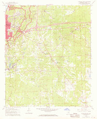
1962 Map of Vicksburg East
USGS Topo · Published 1968About this map
Vicksburg National Military Park dominates the northwest corner of this survey, surrounding the city and preserving the battlements at Fort Hill. The map captures the city during a period of mid-century growth, showing the concentration of institutional landmarks like Kuhn Hospital, Mercy Hospital, and St Aloysius High Sch. Beyond the urban core, the landscape is defined by the winding paths of Glass Bayou and Mint Spring Bayou, while the Old Indian Treaty Boundary cuts a diagonal line across the eastern hills near Newmans Grove.
Find a feature on this map
72 named features on this map. Tap any name to fly to it.
Don’t see what you’re looking for? This feature index may not catch every label — zoom into the map to look around manually.
Map Details
Editions of this 1962 Vicksburg East Map
3 editions found

Other maps of this area

1918 · Vicksburg
USGS Topo · 1:62,500

1938 · Edwards
USGS Topo · 1:62,500

1939 · Yokena
USGS Topo · 1:62,500

1941 · Vicksburg
USGS Topo · 1:62,500

1955 · Jackson
USGS Topo · 1:250,000

1961 · Jackson
USGS Topo · 1:250,000

1962 · Jackson
USGS Topo · 1:250,000

1962 · Redwood
USGS Topo · 1:24,000

1962 · Vicksburg West
USGS Topo · 1:24,000
1962 · Long Lake
USGS Topo · 1:24,000