
1962 Map of Vicksburg East
USGS Topo · Published 1963About this map
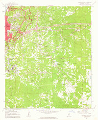
The Vicksburg National Military Park dominates the northwestern corner of this 1962 landscape, preserving the complex topography of the 1863 siege lines. The city of Vicksburg is shown during a period of mid-century expansion, with institutions like Mercy Hospital and St Aloysius High Sch serving the growing community. Significant federal presence is noted at the U S Waterways Experiment Station near Brown Lake, a facility critical to hydraulic engineering research.
Find a feature on this map
63 named features on this map. Tap any name to fly to it.
Don’t see what you’re looking for? This feature index may not catch every label — zoom into the map to look around manually.
Map Details
Editions of this 1962 Vicksburg East Map
3 editions found
Other maps of this area

1918 · Vicksburg
USGS Topo · 1:62,500

1938 · Edwards
USGS Topo · 1:62,500

1939 · Yokena
USGS Topo · 1:62,500

1941 · Vicksburg
USGS Topo · 1:62,500

1955 · Jackson
USGS Topo · 1:250,000

1961 · Jackson
USGS Topo · 1:250,000

1962 · Jackson
USGS Topo · 1:250,000

1962 · Redwood
USGS Topo · 1:24,000

1962 · Vicksburg West
USGS Topo · 1:24,000
1962 · Long Lake
USGS Topo · 1:24,000