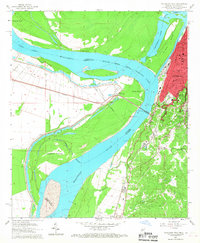
1962 Map of Vicksburg West
USGS Topo · Published 1967About this map
Vicksburg and its complex waterfront dominate this 1960s study of the Mississippi River floodplain. The landscape is defined by dramatic hydrological shifts, notably the Centennial Lake and the Centennial Cutoff, which isolated De Soto Island from the mainland. The city's eastern heights are densely packed with civic institutions, including All Saints College, Cooper High Sch, and Carr Jr High Sch.
Find a feature on this map
34 named features on this map. Tap any name to fly to it.
Don’t see what you’re looking for? This feature index may not catch every label — zoom into the map to look around manually.
Map Details
Editions of this 1962 Vicksburg West Map
3 editions found

Other maps of this area

1909 · Millikens Bend
USGS Topo · 1:24,000

1909 · Mound
USGS Topo · 1:24,000

1910 · Mound
USGS Topo · 1:31,680

1918 · Vicksburg
USGS Topo · 1:62,500

1939 · Talla Bena
USGS Topo · 1:62,500

1939 · Yokena
USGS Topo · 1:62,500

1941 · Vicksburg
USGS Topo · 1:62,500

1955 · Jackson
USGS Topo · 1:250,000

1961 · Jackson
USGS Topo · 1:250,000

1962 · Jackson
USGS Topo · 1:250,000