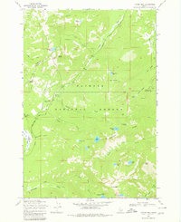
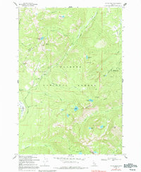
1969 Map of Victor Peak
USGS Topo · Published 1979About this map
Secesh Summit serves as a central landmark within the high-elevation reaches of the Payette National Forest, where the boundary between Idaho and Valley Counties runs through the landscape. This 1960s-era topographic survey illustrates a network of transit routes predating modern highways, including the Summit Warren Wagon Road and a complex system of pack trails that once connected remote alpine basins. These trails link prominent water bodies such as Josephine Lake and Nethker Lake with rugged geographic features like Clochman Saddle and Squaw Point. The map also captures a moment of infrastructure development with a road marked under construction near the North Fork Payette River. High-altitude landmarks such as Victor Peak and Storm Peak anchor the southeastern portion of the sheet, surrounded by glacial lakes including Victor Lake and North Lake.
Find a feature on this map
39 named features on this map. Tap any name to fly to it.
Don’t see what you’re looking for? This feature index may not catch every label — zoom into the map to look around manually.
Map Details
Editions of this 1969 Victor Peak Map
5 editions found
Other maps of this area

1938 · Riggins
USGS Topo · 1:96,000

1945 · Riggins
USGS Topo · 1:125,000

1955 · Grangeville
USGS Topo · 1:250,000

1956 · Burgdorf
USGS Topo · 1:62,500

1956 · Elk City
USGS Topo · 1:250,000

1959 · Grangeville
USGS Topo · 1:250,000

1960 · Elk City
USGS Topo · 1:250,000

1963 · Granite Lake
USGS Topo · 1:24,000

1963 · Black Tip
USGS Topo · 1:24,000

1963 · Hershey Point
USGS Topo · 1:24,000