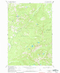
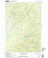
1969 Map of Victor Peak
USGS Topo · Published 1992About this map
Payette National Forest dominates this high-elevation terrain along the border of Idaho and Valley Counties. The landscape is defined by its extensive drainage networks and high-altitude basins, where numerous lakes including Josephine Lake and Nethker Lake feed into creeks like Summit Creek and Nethker Creek. The surveying reveals a wilderness largely navigated by pack trails and a singular wagon road that winds through the north, indicating a territory utilized more for transit and seasonal activity than permanent settlement.
Find a feature on this map
39 named features on this map. Tap any name to fly to it.
Don’t see what you’re looking for? This feature index may not catch every label — zoom into the map to look around manually.
Map Details
Editions of this 1969 Victor Peak Map
5 editions found
Other maps of this area

1938 · Riggins
USGS Topo · 1:96,000

1945 · Riggins
USGS Topo · 1:125,000

1955 · Grangeville
USGS Topo · 1:250,000

1956 · Burgdorf
USGS Topo · 1:62,500

1956 · Elk City
USGS Topo · 1:250,000

1959 · Grangeville
USGS Topo · 1:250,000

1960 · Elk City
USGS Topo · 1:250,000

1963 · Granite Lake
USGS Topo · 1:24,000

1963 · Black Tip
USGS Topo · 1:24,000

1963 · Hershey Point
USGS Topo · 1:24,000