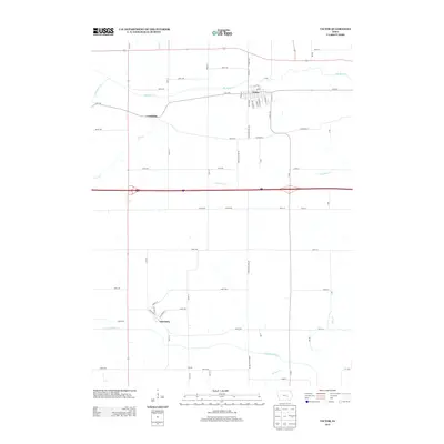
2013 Map of Victor
USGS Topo · Published 2013About this map
The town of Victor sits at the northern edge of this landscape, its street grid defined by names like Main St, Williams St, and Harrison St. This agricultural region is carved by a network of waterways, with Big Bear Creek winding south of town and the North English River flowing through the southern portion of the quadrangle. The settlement of Guernsey anchors the southwestern area, while smaller locales like Carnforth and Verona mark the transition between vast fields and the creek beds of Cub Creek and Jordan Creek. The landscape reflects a deeply organized township system, with a dense grid of rural roads such as Old 6 Road, A Diagonal St, and Poweshiek-Iowa Road facilitating transport between these small Iowa communities.
Find a feature on this map
57 named features on this map. Tap any name to fly to it.
Don’t see what you’re looking for? This feature index may not catch every label — zoom into the map to look around manually.
Map Details
Editions of this 2013 Victor Map
This is the sole edition of this map. No revisions or reprints were ever made.
Other maps of this area

1954 · Des Moines
USGS Topo · 1:250,000

1956 · Des Moines
USGS Topo · 1:250,000

1957 · Des Moines
USGS Topo · 1:250,000

1965 · Ladora
USGS Topo · 1:24,000

1968 · Deep River
USGS Topo · 1:24,000

1968 · Brooklyn
USGS Topo · 1:24,000

1968 · Belle Plaine SW
USGS Topo · 1:24,000

1968 · Victor
USGS Topo · 1:24,000
1968 · Williamsburg NW
USGS Topo · 1:24,000

1968 · Hartwick
USGS Topo · 1:24,000