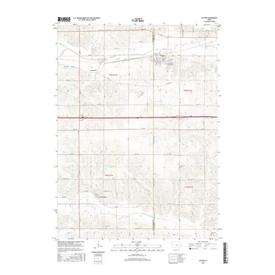
2015 Map of Victor
USGS Topo · Published 2015About this map
Victor and the surrounding Iowa County prairie were defined by an orderly grid of section lines and watercourses during this 2015 survey. The town of Victor serves as the primary hub, where researchers can find the International Order of Odd Fellows Cem and Calvary Cem. To the south, the village of Guernsey sits near the winding North English River, connected to the north by an extensive network of numbered roads like 440th Ave and 450th Ave.
Find a feature on this map
48 named features on this map. Tap any name to fly to it.
Don’t see what you’re looking for? This feature index may not catch every label — zoom into the map to look around manually.
Map Details
Editions of this 2015 Victor Map
This is the sole edition of this map. No revisions or reprints were ever made.
Other maps of this area

1954 · Des Moines
USGS Topo · 1:250,000

1956 · Des Moines
USGS Topo · 1:250,000

1957 · Des Moines
USGS Topo · 1:250,000

1965 · Ladora
USGS Topo · 1:24,000

1968 · Deep River
USGS Topo · 1:24,000

1968 · Brooklyn
USGS Topo · 1:24,000

1968 · Belle Plaine SW
USGS Topo · 1:24,000

1968 · Victor
USGS Topo · 1:24,000
1968 · Williamsburg NW
USGS Topo · 1:24,000

1968 · Hartwick
USGS Topo · 1:24,000