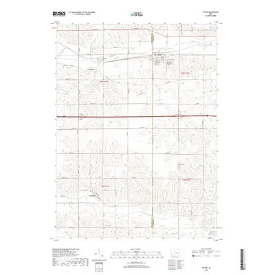
2018 Map of Victor
USGS Topo · Published 2018About this map
Victor serves as a primary hub along the boundary of Poweshiek and Iowa Counties, where local street grids like Blaine St and Cleveland St in Guernsey reveal the planned nature of these rural Iowa communities. The landscape is defined by the drainage patterns of the North English River in the south and Big Bear Creek in the north, creating a series of undulating ridges that dictated the placement of early homesteads and cemeteries. Genealogists will find a high density of burial sites across the township lines, including the International Order of Odd Fellows Cem, Calvary Cem, and the more isolated Wilson Cem. The presence of Carnforth and various named tributaries like Little Bear Creek and Jordan Creek underscores the historical reliance on these waterways and small rail-adjacent junctions for regional transport and agriculture.
Find a feature on this map
49 named features on this map. Tap any name to fly to it.
Don’t see what you’re looking for? This feature index may not catch every label — zoom into the map to look around manually.
Map Details
Editions of this 2018 Victor Map
This is the sole edition of this map. No revisions or reprints were ever made.
Other maps of this area

1954 · Des Moines
USGS Topo · 1:250,000

1956 · Des Moines
USGS Topo · 1:250,000

1957 · Des Moines
USGS Topo · 1:250,000

1965 · Ladora
USGS Topo · 1:24,000

1968 · Deep River
USGS Topo · 1:24,000

1968 · Brooklyn
USGS Topo · 1:24,000

1968 · Belle Plaine SW
USGS Topo · 1:24,000

1968 · Victor
USGS Topo · 1:24,000
1968 · Williamsburg NW
USGS Topo · 1:24,000

1968 · Hartwick
USGS Topo · 1:24,000