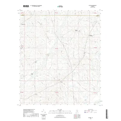
2018 Map of Victoria
USGS Topo · Published 2018About this map
Victoria serves as a central point in this rural Southeast Alabama landscape, where the Coffee and Pike County line meets north of Clowers Crossroads. The terrain is defined by a dense network of tributaries including Whitewater Cr and Tindle Cr, which drain toward the Pea River at the southern edge of the survey. The mapping of Lowry Mill on Whitewater Cr reflects the long-standing reliance on local watercourses for industry and commerce in this agricultural region. Small communities such as Wilkinstown, Chestnut Grove, and Jack are connected by a web of county roads, with several family-named burial sites like Victoria Cem and Rosin Ridge Cem providing vital geographic anchors for genealogical research. The presence of Benedick Airport south of Jump Cr illustrates how modern aviation infrastructure has been integrated into a traditionally agrarian landscape of rolling hills and creek bottoms.
Find a feature on this map
91 named features on this map. Tap any name to fly to it.
Don’t see what you’re looking for? This feature index may not catch every label — zoom into the map to look around manually.
Map Details
Editions of this 2018 Victoria Map
This is the sole edition of this map. No revisions or reprints were ever made.
Other maps of this area

1942 · Enterprise
USGS Topo · 1:125,000

1948 · Brundidge
USGS Topo · 1:62,500

1950 · Enterprise
USGS Topo · 1:62,500

1950 · Brundidge
USGS Topo · 1:62,500

1953 · Andalusia
USGS Topo · 1:250,000

1953 · Dothan
USGS Topo · 1:250,000

1954 · Dothan
USGS Topo · 1:250,000

1955 · Dothan
USGS Topo · 1:250,000

1957 · Andalusia
USGS Topo · 1:250,000

1960 · Brundidge
USGS Topo · 1:24,000