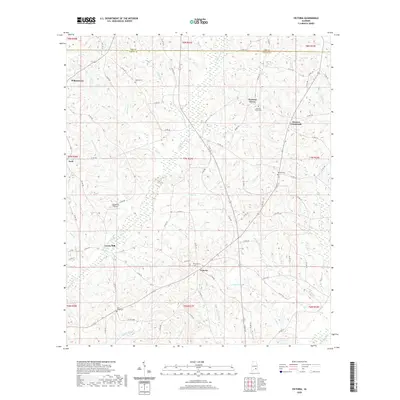
2020 Map of Victoria
USGS Topo · Published 2020About this map
Victoria serves as a central point in this rural landscape of southeastern Alabama, where the transition between Coffee and Pike counties is marked by a network of creeks and small family-named settlements. The area's heritage is visible through several distinct community markers, including Lowry Mill situated along Whitewater Cr and a series of rural burying grounds like Victoria Cem and Rosin Ridge Cem. The terrain is deeply carved by drainage systems, most notably Halls Cr and Tindle Cr, which flow toward the Pea River at the map's southeastern edge.
Find a feature on this map
91 named features on this map. Tap any name to fly to it.
Don’t see what you’re looking for? This feature index may not catch every label — zoom into the map to look around manually.
Map Details
Editions of this 2020 Victoria Map
This is the sole edition of this map. No revisions or reprints were ever made.
Other maps of this area

1942 · Enterprise
USGS Topo · 1:125,000

1948 · Brundidge
USGS Topo · 1:62,500

1950 · Enterprise
USGS Topo · 1:62,500

1950 · Brundidge
USGS Topo · 1:62,500

1953 · Andalusia
USGS Topo · 1:250,000

1953 · Dothan
USGS Topo · 1:250,000

1954 · Dothan
USGS Topo · 1:250,000

1955 · Dothan
USGS Topo · 1:250,000

1957 · Andalusia
USGS Topo · 1:250,000

1960 · Brundidge
USGS Topo · 1:24,000