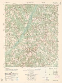
1962 Map of Victoria
USGS Topo · Published 1962About this map
White Water Creek and its many tributaries carve through the rolling landscape of the Pike County and Coffee County line, defining the rural character of this Alabama interior. Small communities and isolated farmsteads are connected by a network of unimproved roads and trails, centering on the settlement of Victoria. The social fabric of the era is evident in the high density of rural houses of worship, such as Chestnut Grove Church and Dorcas Church, which often served as the primary gathering points for local families.
Find a feature on this map
18 named features on this map. Tap any name to fly to it.
Don’t see what you’re looking for? This feature index may not catch every label — zoom into the map to look around manually.
Map Details
Editions of this 1962 Victoria Map
This is the sole edition of this map. No revisions or reprints were ever made.
Other maps of this area

1942 · Enterprise
USGS Topo · 1:125,000

1948 · Brundidge
USGS Topo · 1:62,500

1950 · Enterprise
USGS Topo · 1:62,500

1950 · Brundidge
USGS Topo · 1:62,500

1953 · Andalusia
USGS Topo · 1:250,000

1953 · Dothan
USGS Topo · 1:250,000

1954 · Dothan
USGS Topo · 1:250,000

1955 · Dothan
USGS Topo · 1:250,000

1957 · Andalusia
USGS Topo · 1:250,000

1960 · Brundidge
USGS Topo · 1:24,000