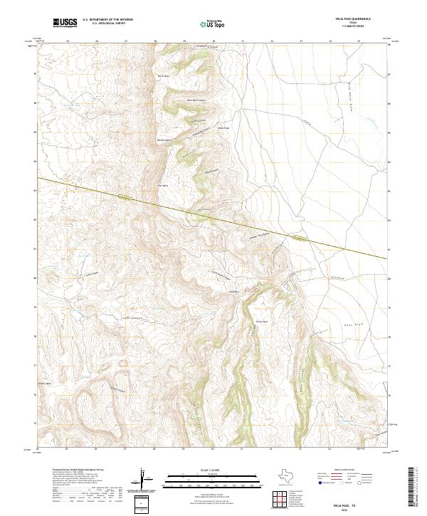
2022 Map of Vieja Pass
USGS Topo · Published 2022About this map
Sierra Vieja dominates this desert landscape where the boundary between Jeff Davis Co and Presidio Co cuts across the high mesas and deep canyons of the Trans-Pecos. This 2022 survey details a remote ranching environment characterized by seasonal water sources and significant topographical relief, from Star Mesa in the center to Soldier Mesa in the southwest. Historical access routes like A Miller Rd and Miller Ranch Rd provide transit across the eastern flats near Wild Horse Draw, while the interior remains defined by its natural hydrology. Named tanks and springs, including Joho Spring and the titular Vieja Spring, suggest the critical importance of water management in this arid terrain, supporting local ranching operations and wildlife through a network of catchments like Hawkeye Tank and Borracho Tank.
Find a feature on this map
38 named features on this map. Tap any name to fly to it.
Don’t see what you’re looking for? This feature index may not catch every label — zoom into the map to look around manually.
Map Details
Editions of this 2022 Vieja Pass Map
This is the sole edition of this map. No revisions or reprints were ever made.
Other maps of this area

1892 · Chispa
USGS Topo · 1:125,000

1895 · Chispa
USGS Topo · 1:125,000

1896 · San Carlos
USGS Topo · 1:125,000

1897 · Chispa
USGS Topo · 1:125,000

1959 · Marfa
USGS Topo · 1:250,000

1965 · Marfa
USGS Topo · 1:250,000
1972 · Soldier Spring
USGS Topo · 1:24,000

1972 · Chispa
USGS Topo · 1:24,000
1972 · Ninetysix Ranch
USGS Topo · 1:24,000
1978 · Dowman Canyon
USGS Topo · 1:24,000