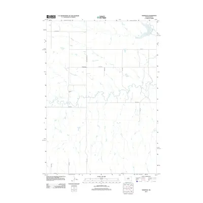
2012 Map of Viewfield
USGS Topo · Published 2012About this map
Elk Cr meanders across this rural Meade County landscape, defining the drainage patterns of a region characterized by section-line roads and open ranch land. The small settlement of Viewfield serves as the focal point for the surrounding community, anchored by the Viewfield Cem located just to the southwest along Pioneer Rd. This survey captures the area’s connectivity via routes like New Underwood Rd and Co Hwy Mc-4, which link scattered homesteads to the wider county network. To the northeast, the waters of Curlew Lake and the drainage of Dry Cr interrupt the geometric precision of the township and range grid, illustrating the reliance on local water sources in this high plains environment. The map provides a clear record of the rural infrastructure and land use established by the early 21st century.
Find a feature on this map
18 named features on this map. Tap any name to fly to it.
Don’t see what you’re looking for? This feature index may not catch every label — zoom into the map to look around manually.
Map Details
Editions of this 2012 Viewfield Map
This is the sole edition of this map. No revisions or reprints were ever made.
Other maps of this area

1953 · Viewfield
USGS Topo · 1:24,000

1953 · Hereford SE
USGS Topo · 1:24,000

1953 · New Underwood
USGS Topo · 1:24,000

1953 · New Underwood SW
USGS Topo · 1:24,000

1953 · Hereford SW
USGS Topo · 1:24,000
1953 · New Underwood NW
USGS Topo · 1:24,000

1953 · Rapid City
USGS Topo · 1:250,000

1954 · Elm Springs SW
USGS Topo · 1:24,000

1957 · Rapid City
USGS Topo · 1:250,000
1957 · Owanka NW
USGS Topo · 1:24,000