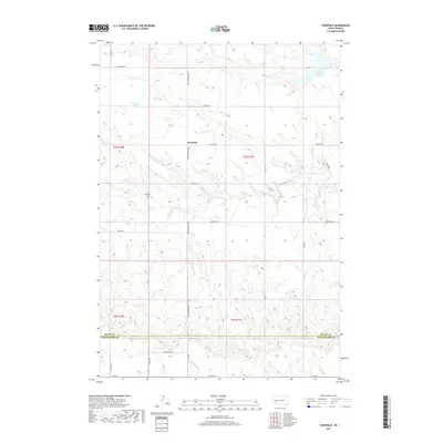
2017 Map of Viewfield
USGS Topo · Published 2017About this map
Viewfield serves as the central point of interest in this western South Dakota prairie landscape, situated near the headwaters of Elk Creek. The terrain is defined by a dendritic drainage pattern where Dry Cr and other small seasonal branches carve through the high plains. A significant jurisdictional boundary is established across the southern portion of the sheet, where Meade Co meets Pennington Co.
Find a feature on this map
26 named features on this map. Tap any name to fly to it.
Don’t see what you’re looking for? This feature index may not catch every label — zoom into the map to look around manually.
Map Details
Editions of this 2017 Viewfield Map
This is the sole edition of this map. No revisions or reprints were ever made.
Other maps of this area

1953 · Viewfield
USGS Topo · 1:24,000

1953 · Hereford SE
USGS Topo · 1:24,000

1953 · New Underwood
USGS Topo · 1:24,000

1953 · New Underwood SW
USGS Topo · 1:24,000

1953 · Hereford SW
USGS Topo · 1:24,000
1953 · New Underwood NW
USGS Topo · 1:24,000

1953 · Rapid City
USGS Topo · 1:250,000

1954 · Elm Springs SW
USGS Topo · 1:24,000

1957 · Rapid City
USGS Topo · 1:250,000
1957 · Owanka NW
USGS Topo · 1:24,000