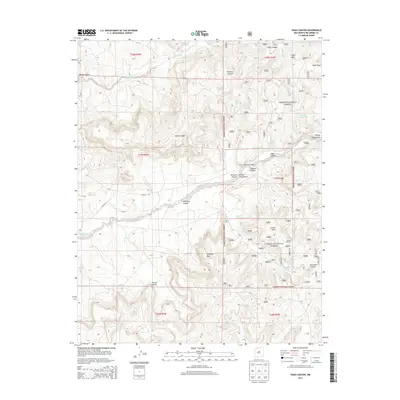
2013 Map of Vigas Canyon
USGS Topo · Published 2013About this map
Carson National Forest encompasses the majority of this high-altitude landscape, where deep drainages like Munoz Canyon and Carrizo Canyon have etched complex patterns into the earth. The area is defined by massive landforms such as Vigas Mesa and Cereza Mesa, providing a look at the hydrography of the San Juan Basin's eastern margins. Water is a critical and sparse resource here, represented by localized points like Candelaria Waterhole, Vigas Spring, and Jaramillo Spring. Small-scale cattle or ranching infrastructure is evident in the scattered distribution of stock tanks, including Deer Tank and Middle Canyon Tank. While modern routes like Co Road 521 cross the terrain, the map reveals a wilderness primarily organized around its natural features, from the heights of Tuckers Ridge to the winding course of Munoz Creek.
Find a feature on this map
38 named features on this map. Tap any name to fly to it.
Don’t see what you’re looking for? This feature index may not catch every label — zoom into the map to look around manually.
Map Details
Editions of this 2013 Vigas Canyon Map
This is the sole edition of this map. No revisions or reprints were ever made.
Other maps of this area

1889 · Largo
USGS Topo · 1:250,000

1895 · Largo
USGS Topo · 1:250,000

1954 · Aztec
USGS Topo · 1:250,000

1958 · Aztec
USGS Topo · 1:250,000

1962 · Aztec
USGS Topo · 1:250,000

1963 · Lapis Point
USGS Topo · 1:24,000

1963 · Schmitz Ranch
USGS Topo · 1:24,000

1963 · Fourmile Canyon
USGS Topo · 1:24,000

1963 · Gobernador
USGS Topo · 1:24,000

1963 · Gonzales Mesa
USGS Topo · 1:24,000